
Source: Bureau of Meteorology
Issued at 9:19 am AWST on Sunday 25 January 2026 Flood Watch
Number: 5
FLOODING LIKELY ACROSS THE FITZROY, SANDY DESERT AND SALT LAKE
DISTRICT FROM SUNDAY ONWARDS
Ex-Tropical Cyclone Luana is forecast to track south and move
inland for the next few days, bringing widespread rainfall, with
likely heavy rainfall across parts of the Flood Watch area.
Inland catchments are relatively dry, with the Fitzroy River
catchment somewhat wetter.
Rainfall totals of 50 to 100 mm with isolated 100 to 150 mm are
forecast across the Flood Watch area from Sunday into early next
week.
In 24 hours to 9:00 am Sunday, rainfall totals recorded in the
West Kimberley District were up to 232 mm. Locations include:
Curtin RAAF 232 mm
Derby RAAF 191 mm
Lombadina Airstrip 158 mm
Dampier Downs Airstrip 156 mm
With forecast rainfall, river and creek level rises are expected
across the Flood Watch area from Sunday. Some communities and
homesteads may become isolated. Hazardous road conditions are
expected, check road conditions before travelling.
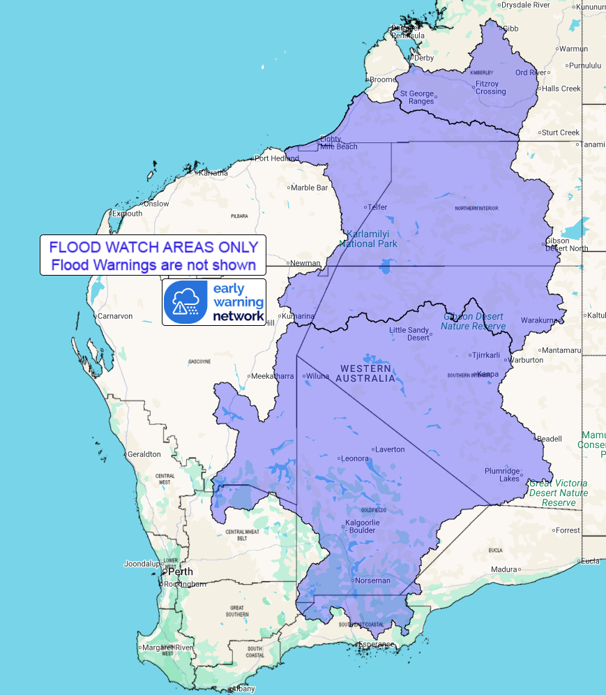
Catchments likely to be affected include:
Fitzroy River (Flooding risk across middle and lower parts)
Salt Lakes District Rivers
Sandy Desert
Flood Warnings are current for the following catchment(s): West
Kimberley and Nth Kimberley
For the latest flood and weather warnings see
www.bom.gov.au/weather-and-climate/warnings-and-alerts
For the latest rainfall and river level information see
www.bom.gov.au/australia/flood
Safety Advice:
* Don't drive, walk, swim or play in floodwater because it is
dangerous.
* Stay away from flooded drains, rivers, streams and
waterways.
* Obey road closure signs. Plan ahead so you don't drive on
flooded roads.
* Check the ABC and local media for updates. The situation can
change quickly, so stay informed.
* For local emergency management warnings and advice visit
www.emergency.wa.gov.au/.
For emergency assistance call SES on telephone number 132 500. In
life-threatening emergencies, call 000 (triple zero)
immediately.
Rainfall and River
Conditions Map
25/Jan/2026 01:43 AM

