
Source: Bureau of Meteorology
Issued at 9:31 am WST on Friday 14 February 2025
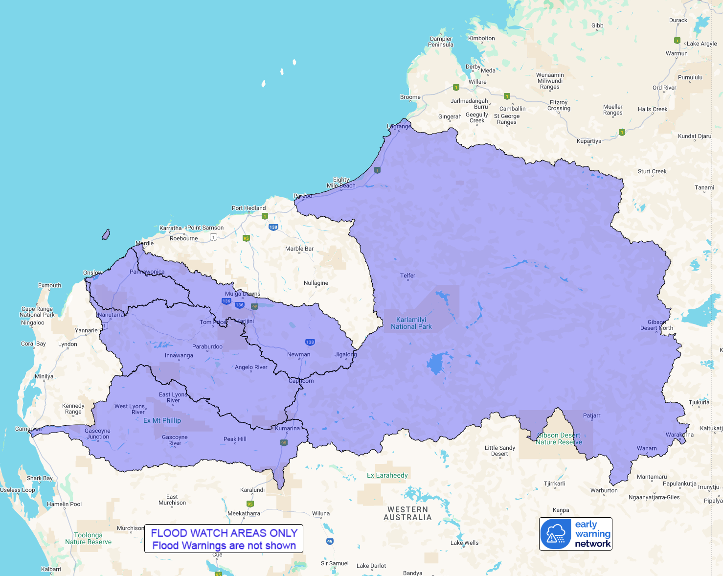
Flood Watch Number: 7
HEAVY TO LOCALLY INTENSE RAINFALL ASSOCIATED WITH SEVERE TROPICAL
CYCLONE ZELIA IS EXPECTED TO CAUSE RAPID RIVER LEVEL RISES AND
WIDESPREAD AREAS OF FLOODING FROM FRIDAY AFTERNOON
Severe Tropical Cyclone Zelia is expected to make landfall near or
just east of Port Hedland Friday afternoon. Heavy rainfall is
expected along the coast and adjacent inland areas during Friday.
Rainfall will become intense near and to the east of the centre of
the cyclone as it crosses the coast. This rainfall will cause rapid
river level rises and widespread flooding across the flood watch
area.
A Tropical Cyclone Advice is current for Severe Tropical Cyclone
Zelia.
Flood warning are also current for the De Grey River and Pilbara
Coastal Rivers catchments.
Catchments across the Flood Watch area, particularly towards the
coast, have become wet with recent rainfall.
Widespread heavy to locally intense rainfall is forecast during
Friday across coastal and adjacent inland areas, extending to
further inland in the the Flood Watch area during the
weekend.
The areas of heaviest rainfall will be dependent of the track of
Severe Tropical Cyclone Zelia.
Forecast rainfall is expected to result in widespread areas of
flooding and rapid river and stream level rises across the Flood
Watch area. Areas of flooding may adversely affect road conditions
and some communities may become isolated. Significant disruption of
transportation network and extensive road closures are
possible.
Catchments likely to be affected include:
Fortescue River
Onslow Coast
Ashburton River
Gascoyne River
Sandy Desert
Flood Warnings are current for the De Grey River and Pilbara
Coastal Rivers catchments.
This flood watch is available by dialling 1300 659 213. For more
information on the Flood Watch Service visit
http://www.bom.gov.au/water/floods/floodWarningServices.shtml
Flood Safety Advice:
DFES advises people and communities to be aware that flooding is
possible and be prepared to relocate equipment and livestock. Watch
water levels. Travellers need to be aware that road conditions may
be adversely affected and travel plans may need to be reconsidered.
Do not drive into water of unknown depth and velocity.
Community information is available from DFES at
www.emergency.wa.gov.au/
Current river levels are available from Department of Water and
Environmental Regulation at
www.water.wa.gov.au/maps-and-data/monitoring/river-level-monitoring
Rainfall and River
Conditions Map
14/Feb/2025 01:49 AM

