
Source: Bureau of Meteorology
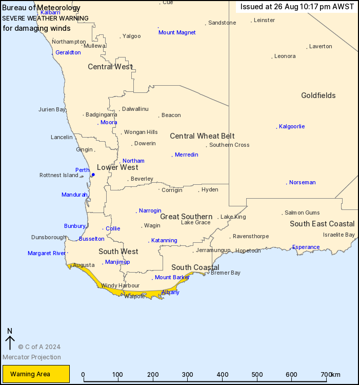
For people in parts of South West and South Coastal
districts.
Issued at 10:17 pm Monday, 26 August 2024.
Damaging winds are possible over the southwestern coastal parts
tonight and tomorrow.
Weather Situation: A strong cold front approaching southwestern WA
brings a vigorous northwesterly flow ahead of it, with gusty
conditions to continue over coastal areas during Monday night.
Gusty showers are expected to continue as the front moves across
the southwest on Tuesday morning.
Isolated DAMAGING WIND GUSTS of around 90 km/h are possible over
the warning area tonight and tomorrow.
Conditions are expected to ease by late Tuesday afternoon.
This is typical weather for this time of year.
Locations which may be affected include Albany, Augusta, Denmark,
Walpole and Windy Harbour.
98 km/h gust observed at Cape Leeuwin at Tuesday 3:27pm.
The Department of Fire and Emergency Services advises that people
should:
* If outside find safe shelter away from trees, power lines, storm
water drains and streams.
* Close your curtains and blinds, and stay inside away from
windows.
* Unplug electrical appliances and do not use land line telephones
if there is lightning.
* If boating, swimming or surfing leave the water.
* Be alert and watch for hazards on the road such as fallen power
lines and loose debris.
* Keep away from flooded drains, rivers, streams and
waterways.
* Be careful of fallen trees, damaged buildings and debris.
* Be careful of fallen power lines. They are dangerous and should
always be treated as live.
* Assess your home, car and property for damage.
* If damage has occurred take photos and contact your insurance
company to organise permanent repairs.
* If your home or property has significant damage, like a badly
damaged roof or flooding, call the SES on 132 500.
26/Aug/2024 02:23 PM

