
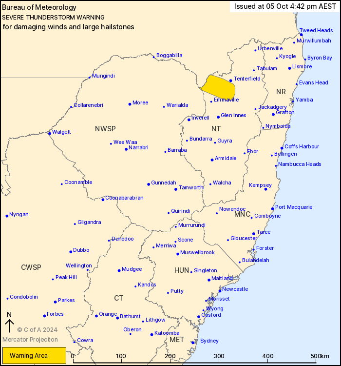
Source: Bureau of Meteorology
For people in parts of Northern Tablelands and North West Slopes
and Plains Forecast Districts.
Issued at 4:42 pm Saturday, 5 October 2024.
Isolated severe thunderstorms are developing over northeastern
NSW.
Weather Situation: A warm and moderately unstable airmass is in
place to the north of a weak trough extending from the northern
tablelands to the northern Mid North Coast and Northern Rivers
area. Thunderstorm activity is expected to remain quite isolated,
however strong winds in the upper atmosphere will help to
strengthen any storms that do manage to develop. Isolated severe
thunderstorms capable of localised damaging winds and large hail
are possible.
Severe thunderstorms are likely to produce damaging winds and
large hailstones in the warning area over the next several
hours.
The State Emergency Service advises that people should:
* Move your car under cover or away from trees.
* Secure or put away loose items around your house, yard and
balcony.
* Keep at least 8 metres away from fallen power lines or objects
that may be energised, such as fences.
* Report fallen power lines to either Ausgrid (131 388), Endeavour
Energy (131 003), Essential Energy (132 080) or Evoenergy (131 093)
as shown on your power bill.
* Trees that have been damaged by fire are likely to be more
unstable and more likely to fall.
* Unplug computers and appliances.
* Avoid using the phone during the storm.
* Stay indoors away from windows, and keep children and pets
indoors as well.
* Stay vigilant and monitor conditions. Note that the landscape
may have changed following bushfires.
* For emergency help in floods and storms, ring the SES (NSW and
ACT) on 132 500.
The next warning is due to be issued by 7:45 pm.
05/Oct/2024 06:54 AM

