
Source: Bureau of Meteorology
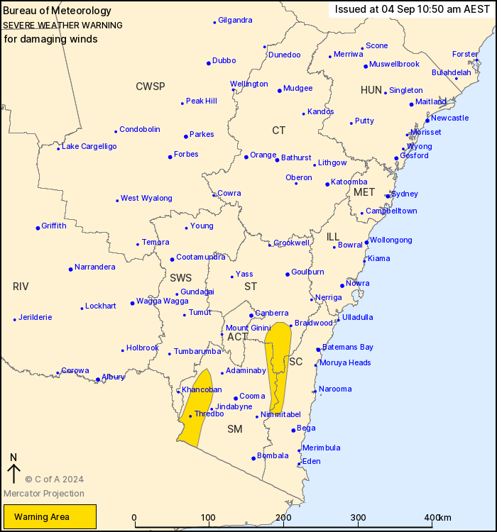
For people in parts of South Coast, Southern Tablelands and Snowy
Mountains Forecast Districts.
Issued at 10:50 am Wednesday, 4 September 2024.
Damaging winds possible over elevated pockets of southeastern NSW
from tonight.
Weather Situation: A strengthening west to northwesterly gradient
is expected as a trough across South Australia moves slowly east
while a ridge across Queensland remains near stationary.
For ALPINE PEAKS above 1900 metres: DAMAGING WINDS averaging 80 to
90 km/h with peak gusts in excess of 110 km/h are possible from
late tonight and continuing through Thursday.
For the SOUTHERN TABLELANDS, SOUTH COAST AND SNOWY MOUNTAINS:
Strong winds averaging 60 to 70 km/h with DAMAGING WIND GUSTS up to
100 km/h are possible Thursday morning till early afternoon.
Winds are expected to increase Friday morning and affect more of
southeastern NSW and parts of the ACT.
Locations which may be affected include Captains Flat, Perisher
Valley, Charlotte Pass and Thredbo.
The State Emergency Service advises that people should:
* Move vehicles under cover or away from trees.
* Secure or put away loose items around your house, yard and
balcony.
* Keep at least 8 metres away from fallen power lines or objects
that may be energised, such as fences.
* Trees that have been damaged by fire are likely to be more
unstable and more likely to fall.
* Report fallen power lines to either Ausgrid (131 388), Endeavour
Energy (131 003), Essential Energy (132 080) or Evoenergy (131 093)
as shown on your power bill.
* Stay vigilant and monitor conditions. Note that the landscape
may have changed following bushfires.
* For emergency help in floods and storms, ring your local SES
Unit on 132 500.
04/Sep/2024 12:56 AM

