
Source: Bureau of Meteorology
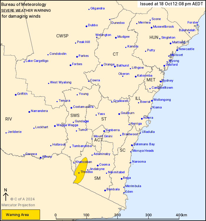
For people in parts of Snowy Mountains and South West Slopes
Forecast Districts.
Issued at 12:08 pm Friday, 18 October 2024.
Damaging winds occurring over alpine areas.
Weather Situation: A deep low pressure system will cross the
southeast of the country today. Vigorous northerly flow ahead of
the low will shift westerly during the afternoon, with gusty
conditions expected.
DAMAGING WINDS averaging 80 to 90 km/h with peak gusts up to
120km/h are likely over alpine areas above 1900 metres.
The risk of DAMAGING WINDS is expected to ease during the
afternoon.
Separate severe thunderstorm warnings are likely during Friday
affecting parts of New South Wales, refer to
http://www.bom.gov.au/nsw/warnings/ for more information.
Locations which may be affected include Perisher Valley, Charlotte
Pass and Thredbo.
Significant wind observations to 12:00 PM AEDT include:
85 km/h mean winds were recorded at Thredbo AWS at around 11:50
AM
The State Emergency Service advises that people should:
* Move vehicles under cover or away from trees.
* Secure or put away loose items around your house, yard and
balcony.
* Keep at least 8 metres away from fallen power lines or objects
that may be energised, such as fences.
* Trees that have been damaged by fire are likely to be more
unstable and more likely to fall.
* Report fallen power lines to either Ausgrid (131 388), Endeavour
Energy (131 003), Essential Energy (132 080) or Evoenergy (131 093)
as shown on your power bill.
* Stay vigilant and monitor conditions. Note that the landscape
may have changed following bushfires.
* For emergency help in floods and storms, ring your local SES
Unit on 132 500.
18/Oct/2024 03:30 AM

