
Source: Bureau of Meteorology
For people in Mount Lofty Ranges, West Coast and parts of Lower
Eyre Peninsula, Eastern Eyre Peninsula, Flinders, Mid North,
Murraylands, North West Pastoral, Riverland and North East Pastoral
districts.
Issued at 10:57 am Wednesday, 9 July 2025.
Damaging winds developing over the West Coast and ranges this
morning, spreading inland throughout the day.
Weather Situation: Another cold front will cross the State today,
leaving behind a vigorous westerly flow in its wake. Damaging winds
are expected to develop behind the front along the West Coast and
Mount Lofty Ranges this morning, particularly in showers. The risk
will spread inland from the coast and into the Flinders Ranges by
the afternoon as the front continues to advance, before easing
throughout by the late evening.
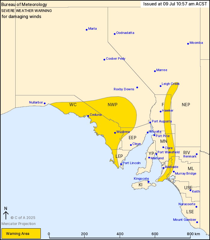
For parts of the WEST COAST, NORTH WEST PASTORAL districts and
parts of the EYRE PENINSULA: West to southwesterly winds with
DAMAGING GUSTS to around 90 km/h are likely to develop near the
coast this morning, then spread further inland during the afternoon
in showers and isolated storms.
For elevated parts of the MOUNT LOFTY and FLINDERS RANGES: Strong
west to northwesterly winds with DAMAGING WIND GUSTS of around 90
km/h remain possible over the Mount Lofty Ranges this morning, with
the risk also extending further north into the Flinders Ranges
during the afternoon.
Winds are expected to ease over the Mount Lofty Ranges during the
afternoon, before easing throughout by the late evening.
Locations which may be affected include Ceduna, Wudinna, Elliston,
Victor Harbor, Burra and Arkaroola.
The State Emergency Service advises that people should:
* Move vehicles under cover or away from trees;
* Secure or put away loose items around your property.
* Stay indoors, away from windows, while conditions are
severe.
09/Jul/2025 01:34 AM


