
Source: Bureau of Meteorology
Issued at 10:45 am Saturday, 11 May 2024.
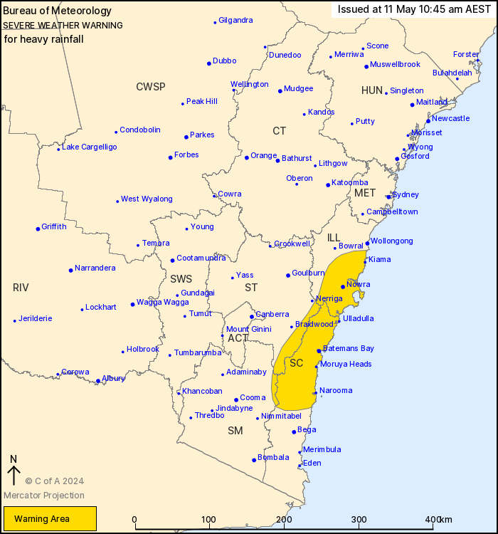
Localised heavy rainfall possible on the South Coast and Illawarra
this weekend.
Weather Situation: A coastal trough about the southeast coast is
forecast to deepen into a coastal low tonight or early Sunday in
response to an upper low over central parts of the state.
HEAVY RAINFALL which may lead to FLASH FLOODING may develop over
the northern parts of the South Coast, southern parts of the
Illawarra, eastern parts of the Southern Tablelands and far
northeastern parts of Snowy Mountains districts from this morning
and persist into Sunday.
Six-hourly rainfall totals between 50 and 70 mm, with isolated 100
to 120 mm possible. 24-hourly totals between 140 to 160 mm are
likely and isolated falls up to 200 mm are possible over the
ranges.
HEAVY RAINFALL is forecast to ease during Sunday evening.
Locations which may be affected include Nowra, Batemans Bay,
Moruya Heads, Ulladulla, Narooma and Araluen.
The State Emergency Service advises that people should:
* Don't drive, ride or walk through flood water.
* Keep clear of creeks and storm drains.
* If you are trapped by flash flooding, seek refuge in the highest
available place and ring 000 if you need rescue.
* Be aware that run-off from rainfall in fire affected areas may
behave differently and be more rapid. It may also contain debris
such as ash, soil, trees and rocks.
* After bushfires, heavy rain and the loss of foliage can make the
ground soft and heavy, leading to a greater chance of
landslides.
* Stay vigilant and monitor conditions. Note that the landscape
may have changed following bushfires.
* For emergency help in floods and storms, ring your local SES
Unit on 132 500.
11/May/2024 12:52 AM


