
Source: Bureau of Meteorology
Issued at 8:00 am AEST on Thursday 29 January 2026 Flood Watch
Number: 8
**Re-issued to correct spatial data
HEAVY RAINFALL AND RIVER LEVEL RISES OCCURRING ACROSS PARTS OF THE
CAPE YORK PENINSULA FURTHER FLOODING POSSIBLE IN NORTHERN
QUEENSLAND OVER THE NEXT FEW DAYS
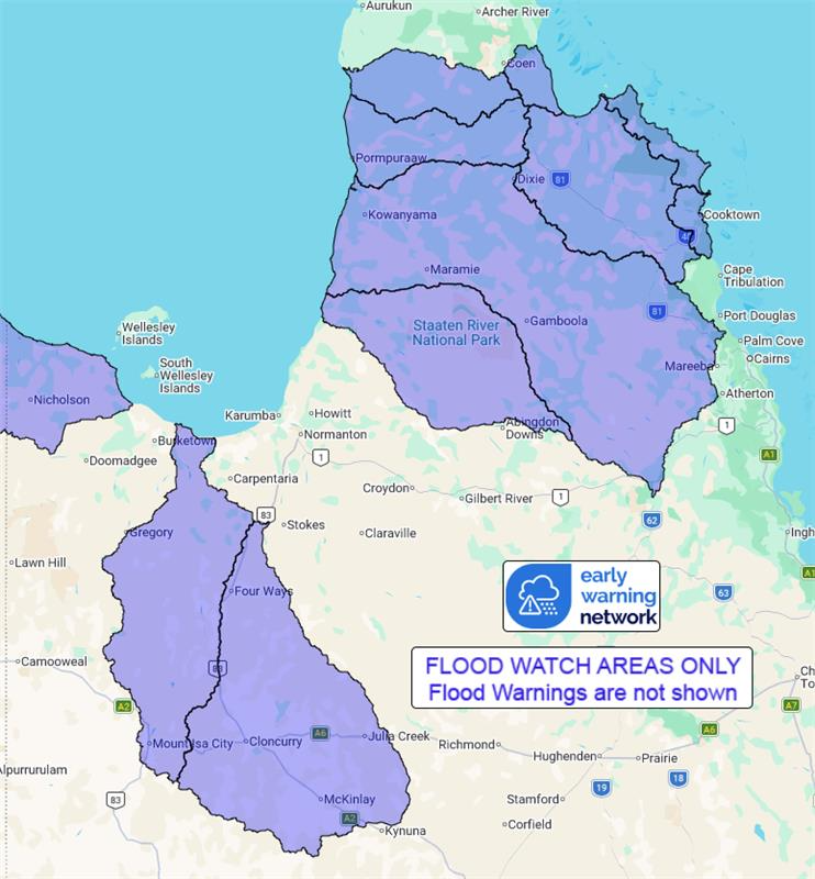
A trough extends east from the Gulf Country, across the Northern
Goldfields and off the North Tropical Coast. The trough will drift
slowly north and be located over the Gulf Coast and Cape York
Peninsula by Friday. Moderate to heavy rainfall may persist in the
Gulf Country and western Peninsula for several days as the trough
lingers.
Catchments in northern Queensland remain wet to saturated with
areas of flooding already occurring following recent rainfall.
Further rainfall may result in rapid river level rises and flooding
across the Flood Watch area over the next few days.
Catchments likely to be affected include:
Stewart River
Normanby River
Jeannie River
Endeavour River
Settlement Creek
Leichhardt River
Cloncurry River
Staaten River
Mitchell River (Major flooding is occurring along
Magnificent Creek at Kowanyama)
Coleman and Edward Rivers
Holroyd and Kendall Rivers
Flood warnings are current for the following catchments: Murray,
Herbert, Nicholson, Upper Flinders, Lower Flinders, Norman and
Gilbert
Flooding is no longer expected in the following catchments:
Daintree, Mossman, Barron, Mulgrave and Russell, Johnstone, Black,
Ross and Bohle and Haughton
For the latest flood and weather warnings see
www.bom.gov.au/weather-and-climate/warnings-and-alerts
For the latest rainfall and river level information see
www.bom.gov.au/australia/flood
Safety Advice:
* Don't drive, walk, swim or play in floodwater because it is
dangerous.
* Stay away from flooded drains, rivers, streams and
waterways.
* Obey road closure signs. Plan ahead so you don't drive on
flooded roads.
* Check the ABC and local media for updates. The situation can
change quickly, so stay informed.
* For local emergency management warnings and advice visit
www.disaster.qld.gov.au/warnings.
Rainfall and River
Conditions Map
29/Jan/2026 02:20 AM

