
Source: Bureau of Meteorology
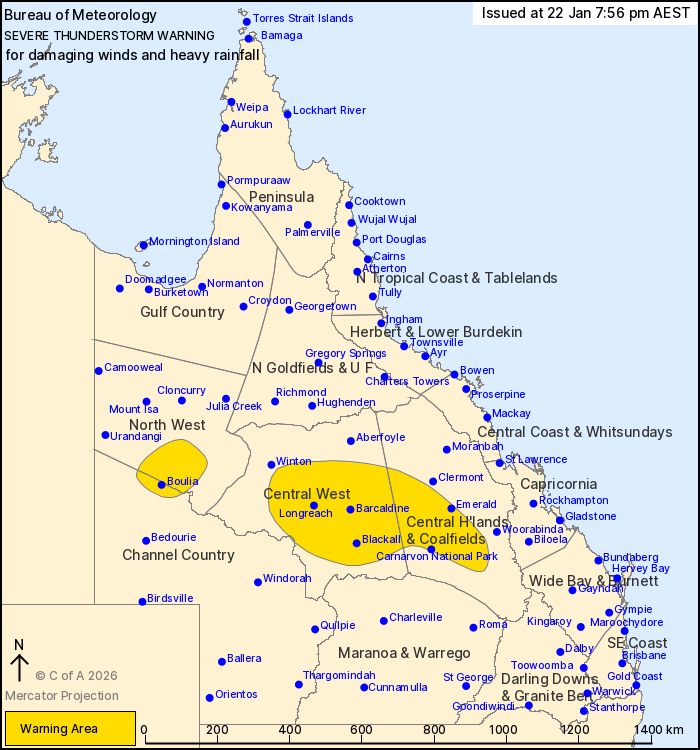
For people in parts of North West, Central Highlands and
Coalfields, Central West and Channel Country Forecast
Districts.
Issued at 7:56 pm Thursday, 22 January 2026.
Severe thunderstorms with possible isolated damaging winds and
heavy rainfall over the central interior this evening.
Weather Situation: A moist and unstable airmass combines with a
trough through the interior to produce severe thunderstorms this
evening.
Severe thunderstorms may produce isolated damaging winds and heavy
rainfall that may lead to flash flooding over the next several
hours in parts of the Central Highlands and Coalfields, Central
West and Channel Country districts. Locations which may be affected
include Emerald, Longreach, Barcaldine, Blackall, Carnarvon
National Park and Isisford.
Severe thunderstorms may produce heavy rainfall that may lead to
flash flooding over the next several hours in parts of the North
West and Channel Country districts. Locations which may be affected
include Boulia.
Severe thunderstorms are no longer occurring in the Maranoa and
Warrego district and the warning for this district is
CANCELLED.
Emergency services advise people to:
* Park your car undercover away from trees.
* Close doors and windows.
* Keep asthma medications close by. Storms and wind can trigger
asthma attacks.
* Charge mobile phones and power banks in case the power goes
out.
* Put your pets somewhere safe and make sure they can be
identified in case they get lost.
* Do not drive now unless you have to because conditions are
dangerous.
* Tell friends, family and neighbours in the area.
22/Jan/2026 10:01 AM

