
Source: Bureau of Meteorology
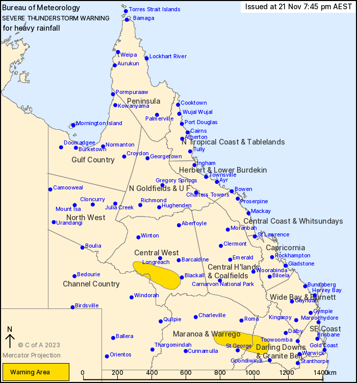
For people in parts of Central West, Maranoa and Warrego, Darling
Downs and Granite Belt and Channel Country Forecast
Districts.
Issued at 7:45 pm Tuesday, 21 November 2023.
Pockets of heavy falls likely across the central and southern
interior of the state.
Weather Situation: A moist and unstable airmass is linking up with
multiple troughs across the state to produce severe thunderstorms
this evening.
Severe thunderstorms are likely to produce heavy rainfall that may
lead to flash flooding in the warning area over the next several
hours. Locations which may be affected include Isisford.
Severe thunderstorms are no longer occurring in the Central
Highlands and Coalfields district and the warning for this district
is CANCELLED.
Queensland Fire and Emergency Services advises that people
should:
* Never drive, walk or ride through flood waters. If it's flooded,
forget it.
* Seek shelter, preferably indoors and never under trees.
* Avoid using the telephone during a thunderstorm.
* Beware of fallen trees and powerlines.
* For emergency assistance contact the SES on 132 500.
21/Nov/2023 09:53 AM


