
Source: Bureau of Meteorology
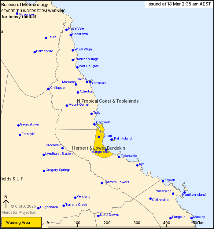
For people in parts of North Tropical Coast and Tablelands and
Herbert and Lower Burdekin Forecast Districts.
Issued at 2:35 am Tuesday, 18 March 2025.
Locally heavy falls likely with bands of showers and isolated
thunderstorms.
Weather Situation: A very moist onshore flow is pushing onto the
northeast Queensland coast, particularly through areas between
Cardwell and Townsville. Moderate instability within this flow will
support slow moving bands of heavy showers and isolated
thunderstorms capable of producing heavy rainfall.
Severe thunderstorms are likely to produce heavy rainfall that may
lead to flash flooding in the warning area over the next several
hours. Locations which may be affected include Paluma, Palm Island,
Ingham, Rollingstone and Lucinda.
93mm was observed in the two hours to 02:26am at Paluma Dam.
Emergency services advise people to:
* Park your car undercover away from trees.
* Close doors and windows.
* Keep asthma medications close by. Storms and wind can trigger
asthma attacks.
* Charge mobile phones and power banks in case the power goes
out.
* Put your pets somewhere safe and make sure they can be
identified in case they get lost.
* Do not drive now unless you have to because conditions are
dangerous.
* Tell friends, family and neighbours in the area.
* Go inside a strong building now. Stay inside until the storm has
passed.
17/Mar/2025 07:11 PM

