
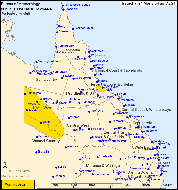
Source: Bureau of Meteorology
For people in parts of Herbert and Lower Burdekin, North West,
Central West and Channel Country Forecast Districts.
Issued at 3:54 am Monday, 24 March 2025.
Heavy rainfall possible about the Townsville Coast as well as
western parts of Queensland.
Weather Situation: Strong showers and embedded thunderstorms are
moving onshore on the northeast coast and thunderstorms keep
developing along surface troughs in the interior of the state in a
very moist tropical airmass. Heavy rainfall is possible with slow
moving or stronger storms over the western parts and with training
showers and embedded storms over Townsville coast.
Severe thunderstorms are likely to produce heavy rainfall that may
lead to flash flooding in the warning area over the next several
hours. Locations which may be affected include Mount Isa,
Townsville, Palm Island, Camooweal, Dajarra and Urandangi.
60mm rainfall in one hour to 1:15am was recorded at Cottonbush
Creek.
Emergency services advise people to:
* Park your car undercover away from trees.
* Close doors and windows.
* Keep asthma medications close by. Storms and wind can trigger
asthma attacks.
* Charge mobile phones and power banks in case the power goes
out.
* Put your pets somewhere safe and make sure they can be
identified in case they get lost.
* Do not drive now unless you have to because conditions are
dangerous.
* Tell friends, family and neighbours in the area.
* Go inside a strong building now. Stay inside until the storm has
passed.
23/Mar/2025 05:59 PM

