
Source: Bureau of Meteorology
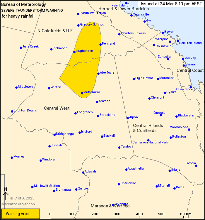
For people in parts of Northern Goldfields and Upper Flinders and
Central West Forecast Districts.
Issued at 8:10 pm Monday, 24 March 2025.
Intense rainfall has now eased, but storms producing heavy
rainfall will continue into the evening.
Weather Situation: A very moist and unstable airmass is in place
over central and northern parts of the state. Severe thunderstorms
are slowly moving to the south and southeast are likely to persist
throughout the evening.
Severe thunderstorms are likely to produce heavy rainfall that may
lead to flash flooding in the warning area over the next several
hours. Locations which may be affected include Hughenden, Pentland,
Torrens Creek and Muttaburra.
A separate Severe Weather Warning for heavy rainfall is currently
in place for other parts of Northern Goldfields and Upper Flinders,
North West, Central West, Channel Country and Maranoa and Warrego
Forecast Districts. For more information see
http://www.bom.gov.au/qld/warnings/
111 MM WAS RECORDED AT MALBOONA IN THE THREE HOURS TO 7:02
PM
63.0 mm was recorded at Prairie in the 60 minutes to 8:00 pm
51.0 mm was recorded at Glendower Crossing in the 30 minutes to
7:14 pm.
47.5 mm was recorded at Porcupine Creek in the 30 minutes to 6:49
pm.
Emergency services advise people to:
* Park your car undercover away from trees.
* Close doors and windows.
* Keep asthma medications close by. Storms and wind can trigger
asthma attacks.
* Charge mobile phones and power banks in case the power goes
out.
* Put your pets somewhere safe and make sure they can be
identified in case they get lost.
* Do not drive now unless you have to because conditions are
dangerous.
* Tell friends, family and neighbours in the area.
* Go inside a strong building now. Stay inside until the storm has
passed.
24/Mar/2025 10:16 AM

