
Source: Bureau of Meteorology
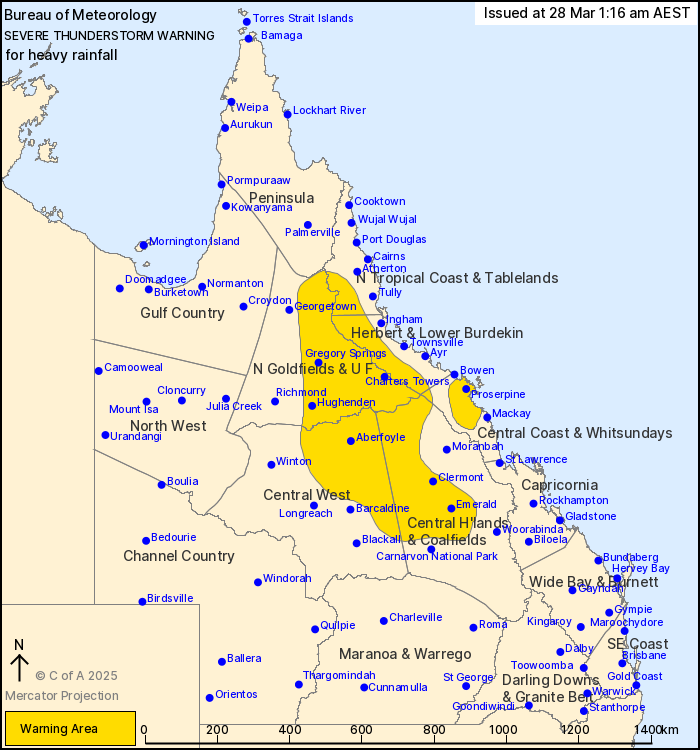
For people in parts of North Tropical Coast and Tablelands,
Northern Goldfields and Upper Flinders, Herbert and Lower Burdekin,
Central Coast and Whitsundays, Central Highlands and Coalfields and
Central West Forecast Districts.
Issued at 1:16 am Friday, 28 March 2025.
Severe thunderstorms with isolated heavy rainfall through inland
Queensland and the Central Coast
Weather Situation: A very humid and unstable airmass extends
through the centre of Queensland to the east of a surface trough.
Slow-moving lines and clusters of showers and thunderstorms are
expected to produce locally heavy rainfall overnight.
Severe thunderstorms are likely to produce heavy rainfall that may
lead to flash flooding in the warning area over the next several
hours. Locations which may be affected include Emerald, Clermont,
Proserpine, Charters Towers, Blackwater and Hughenden.
115 mm was recorded at Teemburra Dam in the 3 hours to
10:34pm.
75 mm was recorded at Mt Emu Plains in the 3 hours to
10:00pm.
Emergency services advise people to:
* Park your car undercover away from trees.
* Close doors and windows.
* Keep asthma medications close by. Storms and wind can trigger
asthma attacks.
* Charge mobile phones and power banks in case the power goes
out.
* Put your pets somewhere safe and make sure they can be
identified in case they get lost.
* Do not drive now unless you have to because conditions are
dangerous.
* Tell friends, family and neighbours in the area.
* Go inside a strong building now. Stay inside until the storm has
passed.
27/Mar/2025 04:32 PM

