
Source: Bureau of Meteorology
For people in parts of Gulf Country, Northern Goldfields and Upper
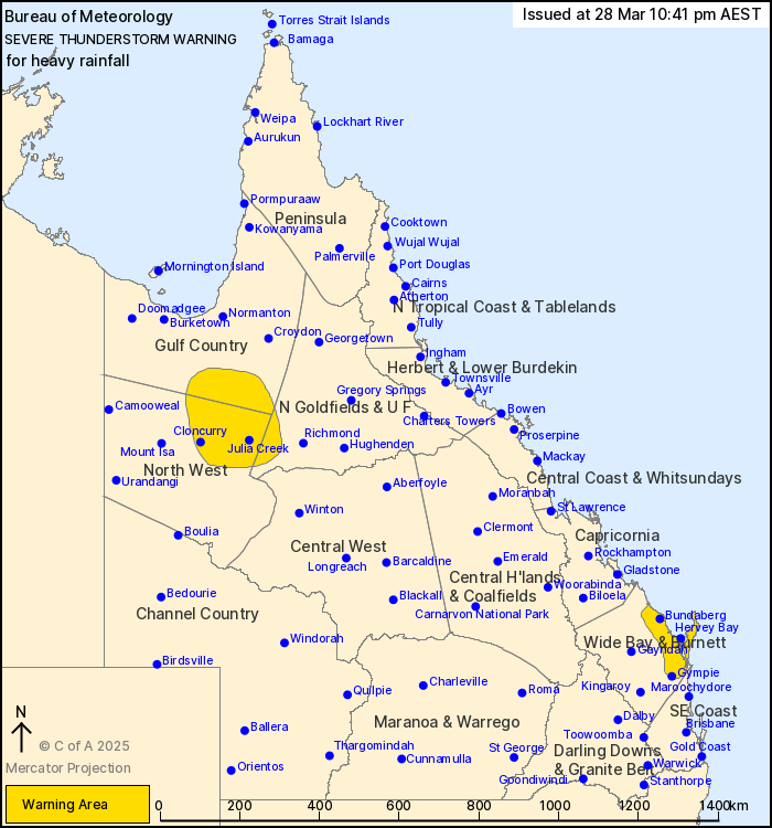
Flinders, North West and Wide Bay and Burnett Forecast
Districts.
Issued at 10:41 pm Friday, 28 March 2025.
Heavy rainfall in showers and storms.
Weather Situation: A moist and unstable airmass offshore of the
Wide Bay is producing heavy falls in showers and thunderstorms
through the southern Wide Bay and Burnett this evening.
A surface trough through northwestern Queensland is also driving
thunderstorms and showers with heavy falls through this
evening.
Severe thunderstorms are likely to produce heavy rainfall that may
lead to flash flooding in the warning area over the next several
hours. Locations which may be affected include Gympie, Bundaberg,
Cloncurry, Maryborough, Hervey Bay, K'gari, Julia Creek, Hervey Bay
waters and Tiaro.
Severe thunderstorms are no longer occurring in the Central West
district and the warning for this district is CANCELLED.
Emergency services advise people to:
* Park your car undercover away from trees.
* Close doors and windows.
* Keep asthma medications close by. Storms and wind can trigger
asthma attacks.
* Charge mobile phones and power banks in case the power goes
out.
* Put your pets somewhere safe and make sure they can be
identified in case they get lost.
* Do not drive now unless you have to because conditions are
dangerous.
* Tell friends, family and neighbours in the area.
* Go inside a strong building now. Stay inside until the storm has
passed.
28/Mar/2025 12:53 PM

