
Source: Bureau of Meteorology
For people in parts of Southeast Coast Forecast District.
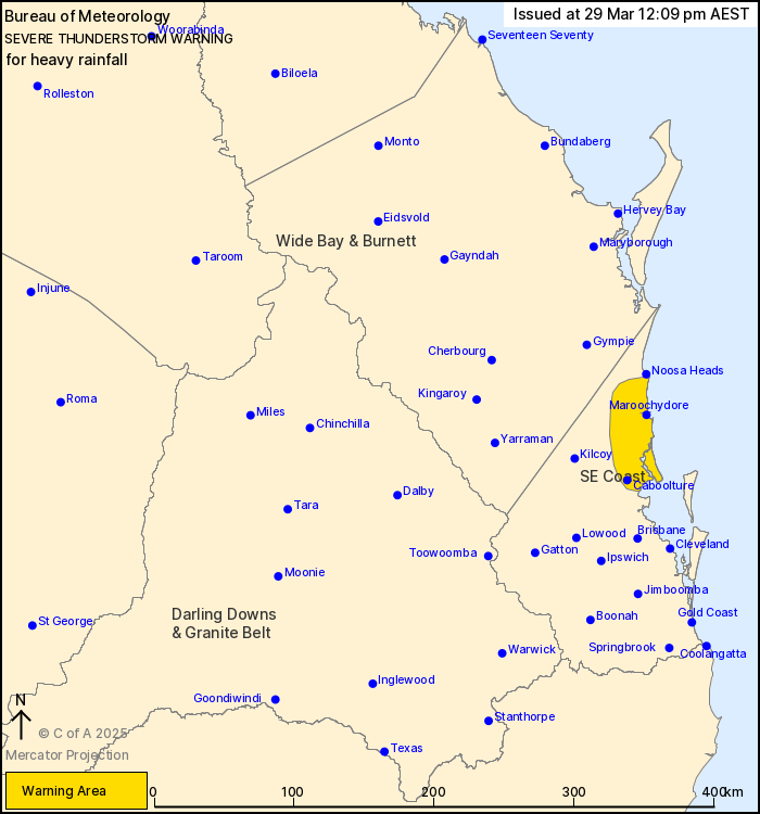
Issued at 12:09 pm Saturday, 29 March 2025.
Heavy rainfall continuing in the southeast.
Weather Situation: A moist and unstable airmass offshore is
producing heavy showers and thunderstorms through the northern
parts of the Southeast Coast district this morning.
Severe thunderstorms are likely to produce heavy rainfall that may
lead to flash flooding in the warning area over the next several
hours. Locations which may be affected include Maroochydore,
Caboolture, Caloundra and Nambour.
Severe thunderstorms are no longer occurring in the Wide Bay and
Burnett district and the warning for this district is
CANCELLED.
Mt Elliot Alert recorded 129 mm of rainfall in 2 hours to
9:14am.
Owanyilla Alert recorded 79 mm of rainfall in 1 hour to
8:05am.
Magnolia Alert recorded 116 mm of rainfall in 3 hours to
7:48am.
Tiaro Alert recorded 87 mm of rainfall in 2 hours to 7:48am.
Kullogum Alert recorded 86 mm of rainfall in 1 hour to
2:00am.
Emergency services advise people to:
* Park your car undercover away from trees.
* Close doors and windows.
* Keep asthma medications close by. Storms and wind can trigger
asthma attacks.
* Charge mobile phones and power banks in case the power goes
out.
* Put your pets somewhere safe and make sure they can be
identified in case they get lost.
* Do not drive now unless you have to because conditions are
dangerous.
* Tell friends, family and neighbours in the area.
* Go inside a strong building now. Stay inside until the storm has
passed.
29/Mar/2025 02:15 AM

