
Source: Bureau of Meteorology
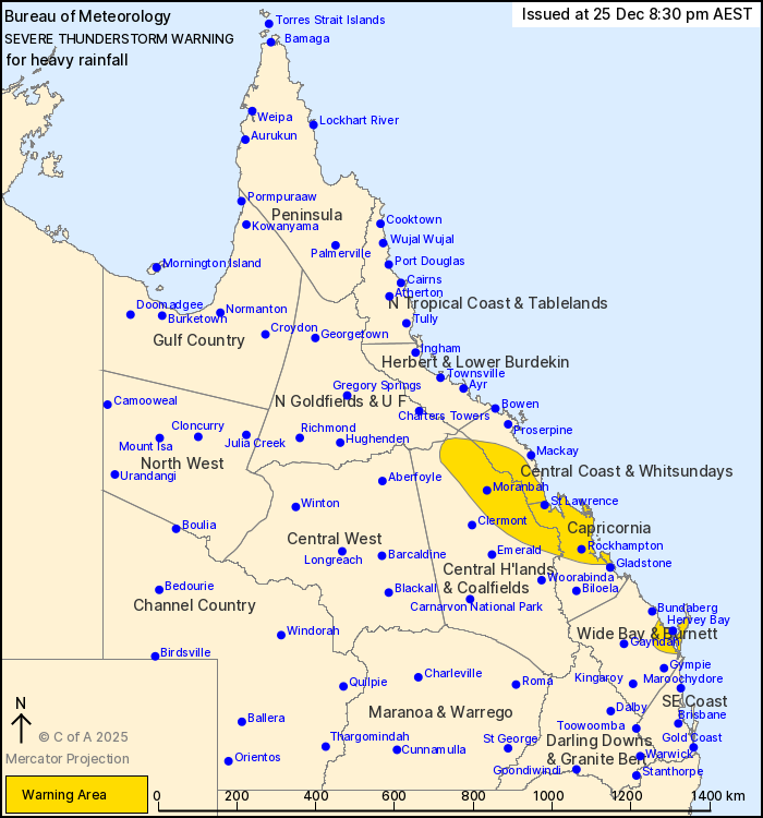
For people in parts of Central Coast and Whitsundays, Central
Highlands and Coalfields, Capricornia and Wide Bay and Burnett
Forecast Districts.
Issued at 8:30 pm Thursday, 25 December 2025.
Severe storms have eased in the southeast but continue about the
Central Coast, Capricornia and Wide Bay.
Weather Situation: Slow moving clusters of severe thunderstorms
embedded in broader rain areas are continuing across parts of the
state in a very moist airmass. Thunderstorms are expected to
continue throughout the evening and into early Friday
morning.
Severe thunderstorms are likely to produce heavy rainfall that may
lead to flash flooding in the warning area over the next several
hours. Locations which may be affected include Rockhampton, Hervey
Bay, Moranbah, St Lawrence, Maryborough, K'gari, Yeppoon, Mount
Morgan and Marlborough.
Severe thunderstorms are no longer occurring in the Central West
and Southeast Coast districts and the warning for these districts
is CANCELLED.
172.0 MM WAS RECORDED AT MAY DOWNS ROAD IN THE 3 HOURS TO 7:37
PM.
81.0 mm was recorded at Gympie in the 2 hours to 7:00 pm.
85.0 mm was recorded at Yatton in the 3 hours to 6:20 pm.
66.0 mm was recorded at Jo Jo Station in the 1 hour to 3:23
pm.
Emergency services advise people to:
* Park your car undercover away from trees.
* Close doors and windows.
* Keep asthma medications close by. Storms and wind can trigger
asthma attacks.
* Charge mobile phones and power banks in case the power goes
out.
* Put your pets somewhere safe and make sure they can be
identified in case they get lost.
* Do not drive now unless you have to because conditions are
dangerous.
* Tell friends, family and neighbours in the area.
* Go inside a strong building now. Stay inside until the storm has
passed.
25/Dec/2025 10:35 AM

