
Source: Bureau of Meteorology
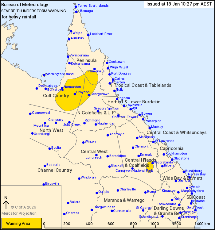
For people in parts of Peninsula, Gulf Country, Northern
Goldfields and Upper Flinders and Central Highlands and Coalfields
Forecast Districts.
Issued at 10:27 pm Sunday, 18 January 2026.
Severe thunderstorms about parts of the tropical north and
southeast.
Weather Situation: Convergence along the Gulf Country through to
the Peninsula district is producing isolated thunderstorms with
heavy rainfall this evening. The remnants of a trough drives an
area of thunderstorms in the Central Highlands and Coalfields this
evening.
Severe thunderstorms are likely to produce heavy rainfall that may
lead to flash flooding in the warning area over the next several
hours. Locations which may be affected include Georgetown, Croydon,
Woorabinda, Donors Hill Station, Blackbull Siding and Iffley.
Severe thunderstorms are no longer occurring in the Capricornia
and Wide Bay and Burnett districts and the warning for these
districts is CANCELLED.
61MM OF RAINFALL WAS RECORDED AT EIDSVOLD IN THE 30 MINUTES TO
7:57 PM.
62MM OF RAINFALL WAS RECORDED AT HORSE CREEK IN THE 30 MINUTES TO
5:32 PM.
61MM OF RAINFALL WAS RECORDED AT TERRAINE IN THE 30 MINUTES TO
11:33 AM.
61mm of rainfall was recorded at Ceratodus in the 1 hour to 8:32
pm.
53mm of rainfall was recorded at Turkey Mountain in the 30 minutes
to 6:09 pm.
42mm of rainfall was recorded at Blaxland in the 30 minutes to
3:54 pm.
Emergency services advise people to:
* Park your car undercover away from trees.
* Close doors and windows.
* Keep asthma medications close by. Storms and wind can trigger
asthma attacks.
* Charge mobile phones and power banks in case the power goes
out.
* Put your pets somewhere safe and make sure they can be
identified in case they get lost.
* Do not drive now unless you have to because conditions are
dangerous.
* Tell friends, family and neighbours in the area.
* Go inside a strong building now. Stay inside until the storm has
passed.
18/Jan/2026 12:33 PM

