
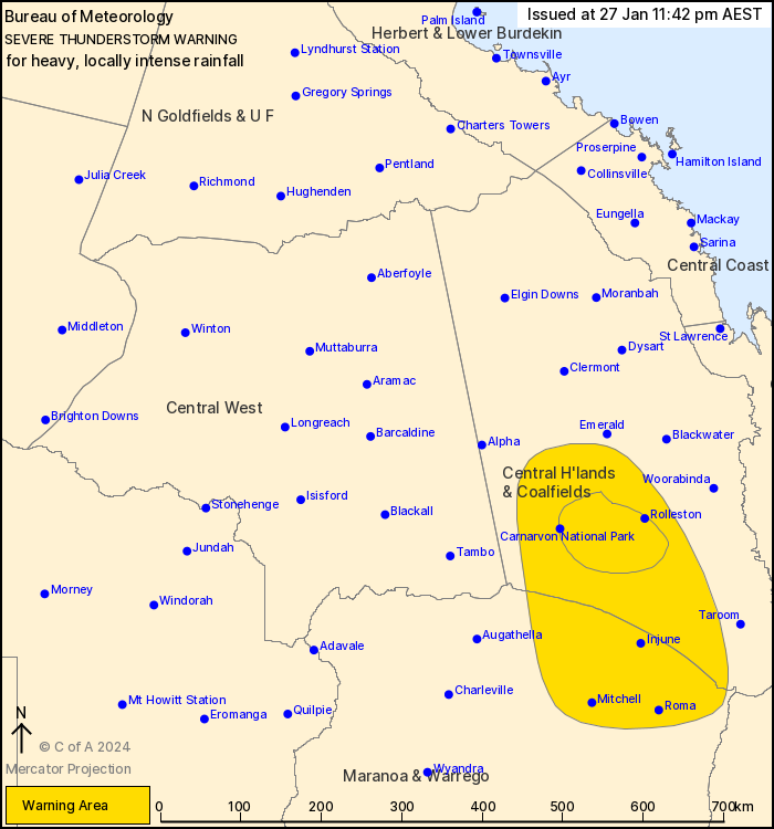
Source: Bureau of Meteorology
For people in parts of Central Highlands and Coalfields and
Maranoa and Warrego Forecast Districts.
Issued at 11:42 pm Saturday, 27 January 2024.
INTENSE RAINFALL FALLING AROUND ROLLESTON.
VERY DANGEROUS THUNDERSTORMS are likely to produce heavy, locally
intense rainfall that may lead to dangerous and life-threatening
flash flooding over the next several hours in parts of the Central
Highlands and Coalfields district. Locations which may be affected
include Rolleston and Carnarvon National Park.
Severe thunderstorms are likely to produce heavy rainfall that may
lead to flash flooding over the next several hours in parts of the
Central Highlands and Coalfields and Maranoa and Warrego districts.
Locations which may be affected include Roma, Mitchell, Springsure,
Injune, Mantuan Downs and Carnarvon National Park.
Severe thunderstorms are no longer occurring in the Central West
district and the warning for this district is CANCELLED.
Adavale Road Alert reported 63 mm of rain in the hour ending at
4:45 pm.
Caroline Crossing reported 70 mm of rain in 2 hours ending at 8:50
pm.
Mt Panorama reported 134 mm of rain in 3 hours ending at 11:27
pm.
Upper Van Dyke reported 43 mm of rain in 30 minutes ending at
11:04 pm.
Raymond reported 68 mm of rain in 2 hours ending at 11:24
pm.
Emergency services advise people to:
* If you have children make sure they are with you or an adult you
trust.
* Park your car undercover away from trees.
* Close doors and windows.
* Keep asthma medications close by. Storms and wind can trigger
asthma attacks.
* Charge mobile phones and power banks in case the power goes
out.
* Put your pets somewhere safe and make sure they can be
identified in case they get lost.
* Do not drive now unless you have to because conditions are
dangerous.
* Tell friends, family and neighbours in the area.
* Go inside a strong building now. Stay inside until the storm has
passed.
27/Jan/2024 01:49 PM

