
Source: Bureau of Meteorology
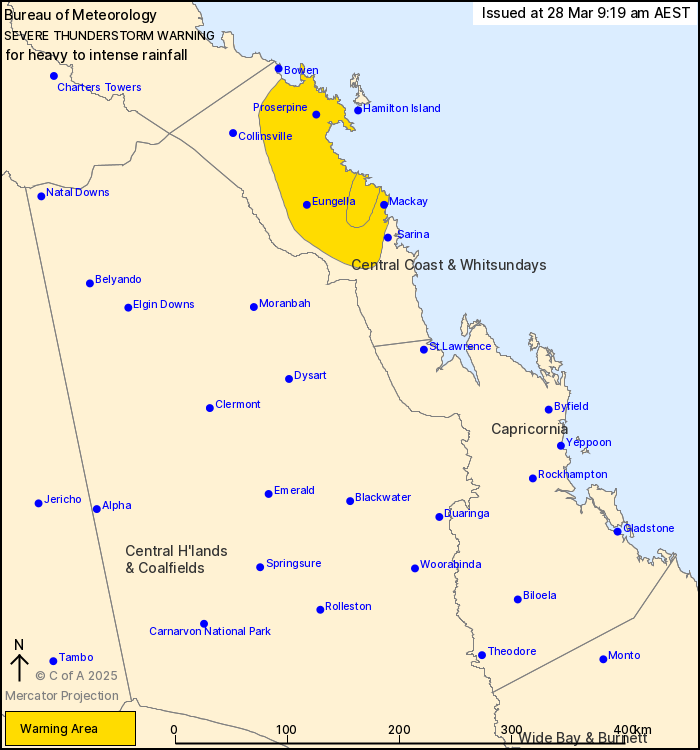
For people in parts of Central Coast and Whitsundays Forecast
District.
Issued at 9:19 am Friday, 28 March 2025.
INTENSE RAINFALL IN HEAVY SHOWERS AND STORMS TO THE WEST AND NORTH
WEST OF MACKAY.
Weather Situation: A trough is combining with a moist and unstable
airmass about the Central Coast of Queensland to produce prolonged
heavy showers and thunderstorms this morning.
Severe thunderstorms are likely to produce heavy rainfall that may
lead to flash flooding over the next several hours in parts of the
Central Coast and Whitsundays district. Locations which may be
affected include Mackay, Proserpine, Eungella and Airlie
Beach.
VERY DANGEROUS THUNDERSTORMS are likely to produce intense
rainfall that may lead to dangerous and life-threatening flash
flooding over the next several hours in parts of the Central Coast
and Whitsundays district.
170 mm was recorded at Dingo Beach in the 6 hours to 7:23
am.
108 mm was recorded at Anthony's Crossing in the 2 hours to 6:39
am.
130 mm was recorded at Marian-Eton Rd in the 2 hours to 6:20
am.
108 mm was recorded at Sandy Plateau in the 3 hours to 3:07
am.
109 mm was recorded at Teemburra Dam in the 6 hours to 03:12
am.
141 mm was recorded at Stafford Crossing in the 3 hours to 1:59
am.
Emergency services advise people to:
* If you have children make sure they are with you or an adult you
trust.
* Park your car undercover away from trees.
* Close doors and windows.
* Keep asthma medications close by. Storms and wind can trigger
asthma attacks.
* Charge mobile phones and power banks in case the power goes
out.
* Put your pets somewhere safe and make sure they can be
identified in case they get lost.
* Do not drive now unless you have to because conditions are
dangerous.
* Tell friends, family and neighbours in the area.
* Go inside a strong building now. Stay inside until the storm has
passed.
27/Mar/2025 11:24 PM

