
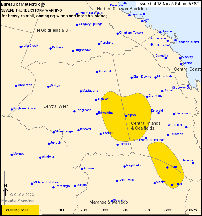
Source: Bureau of Meteorology
For people in parts of Central Highlands and Coalfields, Central
West and Maranoa and Warrego Forecast Districts.
Issued at 5:54 pm Saturday, 18 November 2023.
Slow-moving thunderstorms over central QLD
A surge of moist and unstable air is flowing from the central
coast towards a trough in the central interior. Isolated severe
thunderstorms have developed within this airmass near the Central
Highlands, and are expected to continue until later this
evening.
Severe thunderstorms are likely to produce heavy rainfall that may
lead to flash flooding, damaging winds and large hailstones in the
warning area over the next several hours. Locations which may be
affected include Roma, Injune, Bogantungan, Jericho, Mantuan Downs
and Alpha.
Queensland Fire and Emergency Services advises that people
should:
* Move your car under cover or away from trees.
* Secure loose outdoor items.
* Never drive, walk or ride through flood waters. If it's flooded,
forget it.
* Seek shelter, preferably indoors and never under trees.
* Avoid using the telephone during a thunderstorm.
* Beware of fallen trees and powerlines.
* For emergency assistance contact the SES on 132 500.
18/Nov/2023 09:21 AM


