
Source: Bureau of Meteorology
for DAMAGING WINDS, LARGE HAILSTONES and HEAVY RAINFALL
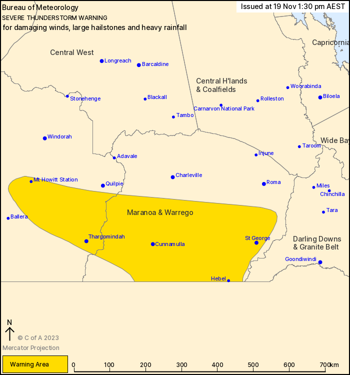
For people in parts of Channel Country and Maranoa and Warrego
Forecast Districts.
Issued at 1:30 pm Sunday, 19 November 2023.
Severe thunderstorms developing in the Southern Interior
Weather Situation: a moist northeasterly wind is converging into a
trough in the interior, with unstable conditions maintained by an
approaching upper level low. Thunderstorm activity has been rapidly
developing today in the Southern Interior, with an expectation of
severe thunderstorms continuing through this evening and possibly
overnight as the upper low gets closer.
Severe thunderstorms are likely to produce damaging winds, large
hailstones and heavy rainfall that may lead to flash flooding in
the warning area over the next several hours. Locations which may
be affected include Thargomindah, Cunnamulla, St George, Mt Howitt
Station, Hebel and Bollon.
Queensland Fire and Emergency Services advises that people
should:
* Move your car under cover or away from trees.
* Secure loose outdoor items.
* Never drive, walk or ride through flood waters. If it's flooded,
forget it.
* Seek shelter, preferably indoors and never under trees.
* Avoid using the telephone during a thunderstorm.
* Beware of fallen trees and powerlines.
* For emergency assistance contact the SES on 132 500.
19/Nov/2023 03:41 AM


