
Source: Bureau of Meteorology
For people in parts of Southeast Coast Forecast District.
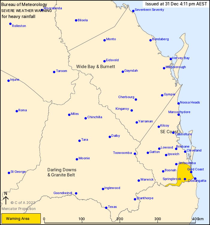
Issued at 4:11 pm Sunday, 31 December 2023.
Heavy rainfall possible about the Gold Coast and Hinterland region
during Monday.
Weather Situation: A persistent, humid easterly airflow and subtle
coastal trough near the southeast Queensland coast, together with
an upper-level trough, is expected to increase shower and
thunderstorm activity in the warning area during Monday.
HEAVY RAINFALL which may lead to FLASH FLOODING is forecast for
the southern parts of the Southeast Coast during Monday. Three to
six-hourly rainfall totals between 80 and 160 mm are possible, with
isolated 24-hourly totals exceeding 200 mm possible, more likely
about the ranges.
Heavy rainfall will be associated with shower and thunderstorm
activity, which is likely to be hit-and-miss in nature across the
warning area. There is a risk that heavy rainfall could develop as
soon as the early hours of Monday morning, but the risk becomes
more likely by the afternoon. There is significant uncertainty in
the movement and timing of features, but at this stage the heavy
rainfall risk may persist into Tuesday morning.
A Flood Watch is current for areas in southeast Queensland, and
flood warnings may issued as required. Please refer to
http://www.bom.gov.au/qld/warnings/
Locations which may be affected include Gold Coast, Coolangatta,
Mount Tamborine and Springbrook.
Emergency services advise people to:
* Park your car undercover away from trees.
* Close doors and windows.
* Keep asthma medications close by. Storms and wind can trigger
asthma attacks.
* Charge mobile phones and power banks in case the power goes
out.
* Put your pets somewhere safe and make sure they can be
identified in case they get lost.
* Do not drive now unless you have to because conditions are
dangerous.
* Tell friends, family and neighbours in the area.
* Go inside a strong building now. Stay inside until the storm has
passed.
31/Dec/2023 06:26 AM

