
Source: Bureau of Meteorology
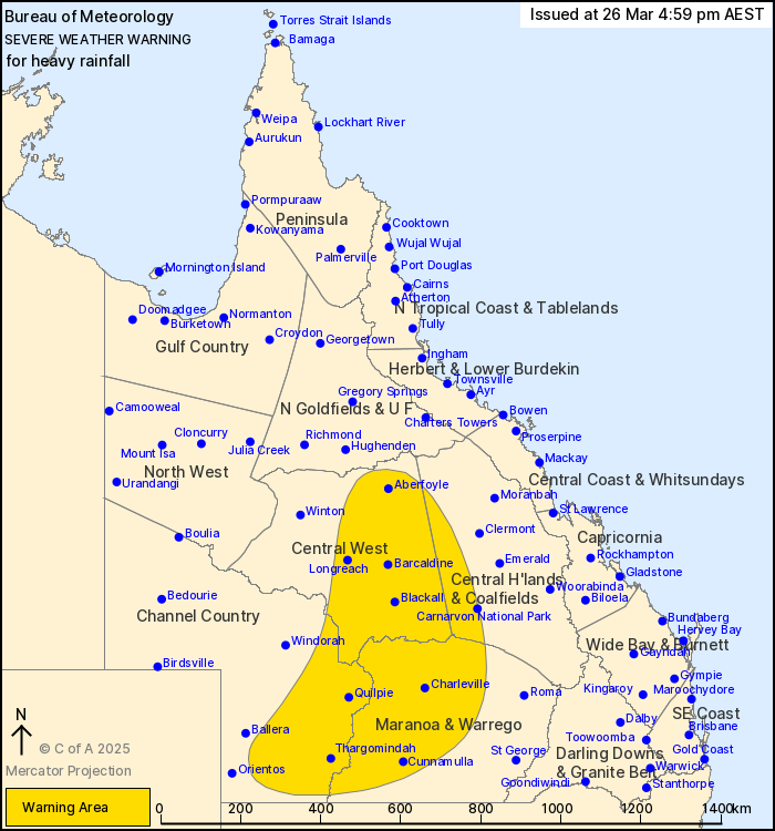
For people in parts of Central Highlands and Coalfields, Central
West, Channel Country and Maranoa and Warrego Forecast
Districts.
Issued at 4:59 pm Wednesday, 26 March 2025.
Heavy rainfall continues over the western interior, shifting
further south and east tonight.
Weather Situation: A deep surface trough has combined with a very
moist tropical airmass and upper feature to generate widespread
heavy rainfall over the western interior for the past few days.
Areas of scattered heavy rainfall are expected to continue tonight
with the focus slowly shifting further south and east, likely
persisting into Thursday with an overnight peak in rainfall
expected again. Across northern parts of the warning area, heavy
rainfall is likely to become more isolated and fall from scattered
showers and isolated thunderstorms.
HEAVY RAINFALL which may lead to FLASH FLOODING is likely to
continue through the warning area during the rest of today and into
Thursday morning, with a general southward trend of the heaviest
falls. Six-hourly rainfall totals between 30 and 60 mm are likely,
with isolated falls of up to 120 mm possible. 24-hourly rainfall
totals of between 70 to 120 mm are likely, with isolated totals of
up to 180 mm possible.
A separate Severe Thunderstorm Warning will be issued if very
dangerous thunderstorms with intense rainfall are detected.
North of Blackall: Heavy rainfall is likely to become more
isolated throughout the night and may ease below severe thresholds
by Thursday morning.
South of Blackall: Heavy rainfall is expected to continue tonight
and is likely to persist into Thursday.
Flood Watches and Warnings have been issued for multiple
catchments in the west and centre of the state. See
http://www.bom.gov.au/qld/warnings/ for more information.
Locations which may be affected include Thargomindah, Charleville,
Longreach, Quilpie, Isisford and Barcaldine.
Significant rainfall observations recorded recently:
93.0 mm at Bogewong in the 6 hours to 3:00 pm.
Significant 24-hour rainfall totals to 4:00 pm:
324.0 mm at Bogewong.
253.0 mm at Stonehenge.
217.0 mm at Mountain View.
168.6 mm at Winton.
Emergency services advise people to:
* Park your car undercover away from trees.
* Close doors and windows.
* Keep asthma medications close by. Storms and wind can trigger
asthma attacks.
* Charge mobile phones and power banks in case the power goes
out.
* Put your pets somewhere safe and make sure they can be
identified in case they get lost.
* Do not drive now unless you have to because conditions are
dangerous.
* Tell friends, family and neighbours in the area.
* Go inside a strong building now. Stay inside until the storm has
passed.
26/Mar/2025 07:04 AM

