
Source: Bureau of Meteorology
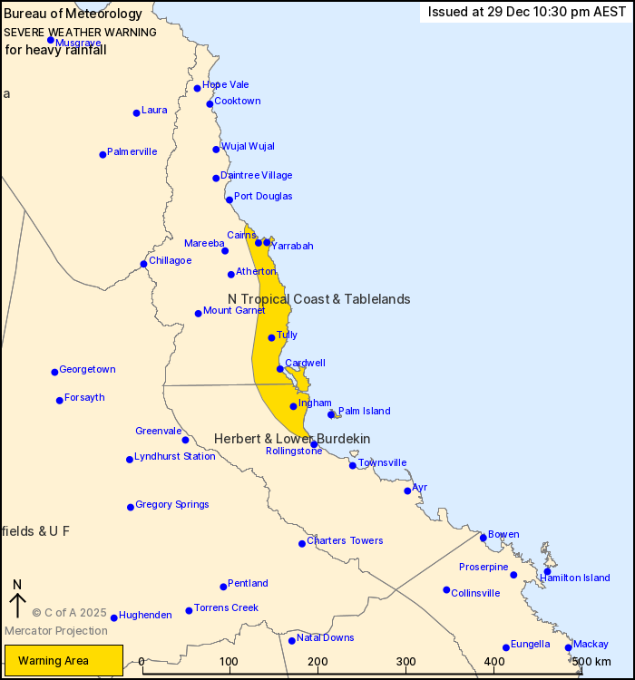
For people in parts of North Tropical Coast and Tablelands and
Herbert and Lower Burdekin Forecast Districts.
Issued at 10:30 pm Monday, 29 December 2025.
Heavy rainfall possible this evening, persisting into tomorrow for
the northeast tropical coast.
Weather Situation: Areas of converging enhanced onshore winds over
the northeast tropical coast bring the risk of heavy rainfall this
evening and tomorrow.
HEAVY RAINFALL which may lead to FLASH FLOODING is forecast for
areas between Cairns and north of Rollingstone this evening,
persisting through Tuesday morning. Six-hourly rainfall totals
between 100 to 180 mm are likely, with isolated falls up to 220 mm
possible.
A separate Severe Thunderstorm Warning will be issued if very
dangerous thunderstorms with intense rainfall are detected.
A separate Severe Weather Warning is current for northwestern
Queensland. Flood Watches and Flood Warnings are current for
Northern Queensland. Please refer to
https://www.bom.gov.au/weather-and-climate/warnings-and-alerts for
more information.
Locations which may be affected include Cairns, Palm Island,
Ingham, Yarrabah, Cardwell and Tully.
290 MM OF RAINFALL WAS RECORDED AT COWLEY BEACH IN THE 6 HOURS TO
6:02 PM.
Emergency services advise people to:
* Park your car undercover away from trees.
* Close doors and windows.
* Keep asthma medications close by. Storms and wind can trigger
asthma attacks.
* Charge mobile phones and power banks in case the power goes
out.
* Put your pets somewhere safe and make sure they can be
identified in case they get lost.
* Do not drive now unless you have to because conditions are
dangerous.
* Tell friends, family and neighbours in the area.
* Go inside a strong building now. Stay inside until the storm has
passed.
29/Dec/2025 12:38 PM

