
Source: Bureau of Meteorology
For people in parts of Gulf Country Forecast District.
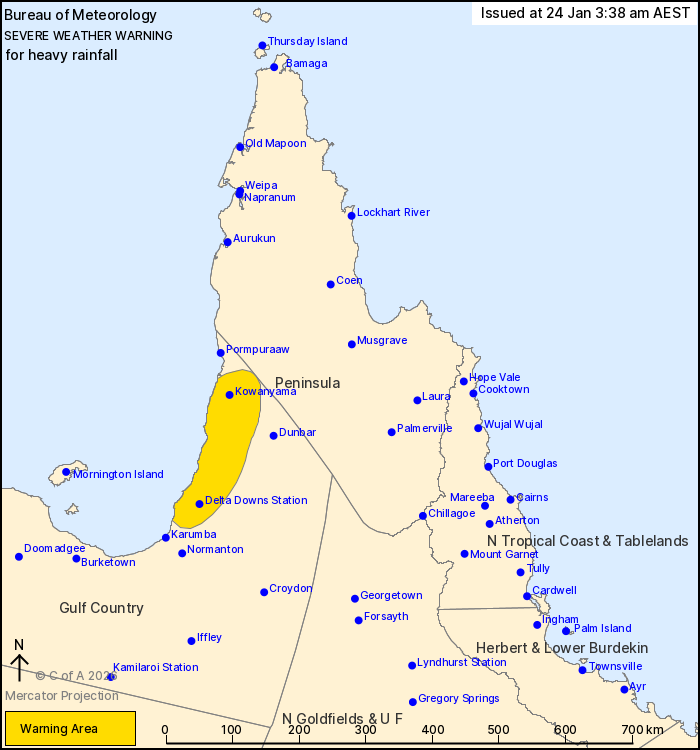
Issued at 3:38 am Saturday, 24 January 2026.
Heavy rainfall has developed about a tropical low near the western
Cape York Peninsula.
Weather Situation: A small tropical low pressure system lies near
the western Cape York Peninsula coast. Persistent, heavy showers
and thunderstorms to the south of this system are bringing areas of
heavy rainfall.
HEAVY RAINFALL which may lead to FLASH FLOODING is forecast for
areas in central western Cape York Peninsula. Six-hourly rainfall
totals between 80 and 150 mm are likely, with isolated totals
exceeding 200 mm possible.
Conditions are expected to continue during Saturday with the
tropical low pressure system slow moving, however there is high
uncertainty around its movement and development so the situation
remains closely monitored.
Flood Watches are current in the area. Refer to
https://www.bom.gov.au/weather-and-climate/warnings-and-alerts
Locations which may be affected include Kowanyama and Delta Downs
Station.
Severe weather is no longer occurring in the Peninsula district
and the warning for this district is CANCELLED.
94.0mm has fallen at Kowanyama in the 6hours from 9pm Friday 23
January to 3am Saturday 24 January with a total of 195.8mm fallen
since 9am Friday 23 January 2026.
Emergency services advise people to:
* Park your car undercover away from trees.
* Close doors and windows.
* Keep asthma medications close by. Storms and wind can trigger
asthma attacks.
* Charge mobile phones and power banks in case the power goes
out.
* Put your pets somewhere safe and make sure they can be
identified in case they get lost.
* Do not drive now unless you have to because conditions are
dangerous.
* Tell friends, family and neighbours in the area.
* Go inside a strong building now. Stay inside until the storm has
passed.
23/Jan/2026 07:10 PM

