
Source: Bureau of Meteorology
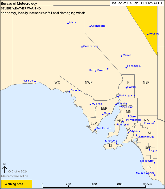
For people in parts of North East Pastoral district.
Issued at 11:01 am Sunday, 4 February 2024.
HEAVY TO LOCALLY INTENSE RAINFALL TO DEVELOP IN THE NORTHEAST THIS
EVENING.
Weather Situation: Ex-Tropical Cyclone Kirrily is currently
located near the Queensland and Northern Territory border to the
north of the State. The system will continue to move to the
south-southeast today and is expected to enter into the North East
Pastoral District during the evening, before continuing to track
further southeast to clear South Australia by Monday
afternoon.
HEAVY RAINFALL which may lead to FLASH FLOODING is expected about
northeastern parts of the North East Pastoral District during
Sunday evening and continuing into Monday morning. Six-hourly
rainfall totals between 40 and 80 mm are likely. 24-hourly totals
between 80 and 120 mm are possible.
Locally INTENSE RAINFALL which may lead to DANGEROUS AND
LIFE-THREATENING FLASH FLOODING is also possible close to the low,
particularly on the southern side of the system. Isolated
six-hourly totals between 80 and 100 mm are possible with 24-hourly
totals exceeding 140 mm. A separate Severe Thunderstorm Warning
will be issued if VERY DANGEROUS THUNDERSTORMS with INTENSE
RAINFALL are detected.
DAMAGING WIND GUSTS in excess of 90 km/h are also possible in
thunderstorms within the warning area during Sunday and into
Monday.
Conditions are expected to ease by Monday afternoon as the system
moves away to the southeast.
Locations which may be affected include Moomba and
Innamincka.
The State Emergency Service advises that people should:
* Don't drive, ride or walk through flood water;
* Keep clear of creeks and storm drains;
* Move vehicles under cover or away from trees;
* Secure or put away loose items around your property.
* Stay indoors, away from windows, while conditions are
severe.
04/Feb/2024 01:03 AM


