
Source: Bureau of Meteorology
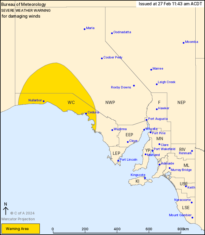
For people in West Coast and parts of North West Pastoral
districts.
Issued at 11:43 am Tuesday, 27 February 2024.
Possible damaging winds during Tuesday afternoon with the passage
of a cold front.
Weather Situation: A sharp cold front is developing in the far
west of the State and is forecast to reach Cook to Nullarbor by
late afternoon and extend to around Streaky Bay to Tarcoola in the
late evening. Fresh and gusty north to northwesterly winds will
shift sharply to west to southwesterly with the passage of the
front.
Strong winds averaging 50-60 km/h and DAMAGING WIND GUSTS with
peak gusts of around 90 km/h are possible in the warning area with
the passage of the front from Tuesday afternoon. Winds are most
likely immediately ahead of the front and within an hour or two
post front.
Conditions will ease from the west in the late afternoon and
extend throughout by late evening.
Locations which may be affected include Ceduna, Maralinga, Cook,
Nullarbor, Fowlers Bay and Streaky Bay.
The State Emergency Service advises that people should:
* Move vehicles under cover or away from trees;
* Secure or put away loose items around your property.
* Stay indoors, away from windows, while conditions are
severe.
27/Feb/2024 01:19 AM


