
Source: Bureau of Meteorology
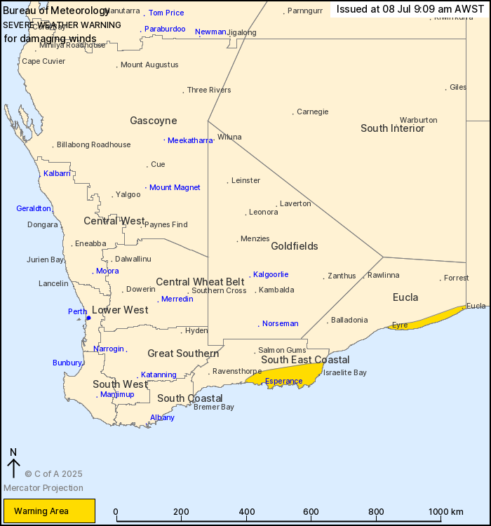
For people in parts of Eucla and South East Coastal
districts.
Issued at 9:09 am Tuesday, 8 July 2025.
Damaging winds developing in the southeast this evening.
Weather Situation: A vigorous southwesterly flow is expected to
develop in the wake of a cold front in the South East Coastal
district this evening, before extending to parts of the Eucla
coastline early Wednesday morning. Winds will begin easing from the
west of the warning area by sunrise on Wednesday and clear to the
east by midday.
DAMAGING WINDS averaging 50 to 65 km/h with peak gusts up to 100
km/h are expected over parts of the South East Coastal district
from this evening, extending to the Eucla coastal fringe east of
Eyre in the early hours of Wednesday morning.
Winds are forecast to ease below warning thresholds late Wednesday
morning.
Locations which may be affected include Esperance, Eucla, Eyre and
Israelite Bay.
The Department of Fire and Emergency Services advises that people
should:
* If outside find safe shelter away from trees, power lines, storm
water drains and streams.
* Close your curtains and blinds, and stay inside away from
windows.
* Unplug electrical appliances and do not use land line telephones
if there is lightning.
* If boating, swimming or surfing leave the water.
* Be alert and watch for hazards on the road such as fallen power
lines and loose debris.
* Keep away from flooded drains, rivers, streams and
waterways.
* Be careful of fallen trees, damaged buildings and debris.
* Be careful of fallen power lines. They are dangerous and should
always be treated as live.
* Assess your home, car and property for damage.
* If damage has occurred take photos and contact your insurance
company to organise permanent repairs.
* If your home or property has significant damage, like a badly
damaged roof or flooding, call the SES on 132 500.
08/Jul/2025 01:17 AM


