
Source: Bureau of Meteorology
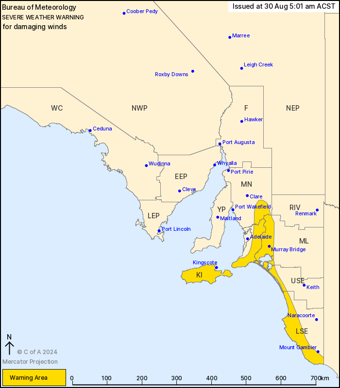
For people in Mount Lofty Ranges, Kangaroo Island and parts of Mid
North, Murraylands, Upper South East and Lower South East
districts.
Issued at 5:01 am Friday, 30 August 2024.
Damaging winds developing over the south during early
morning.
Weather Situation: A strong cold front passed over the south of
South Australia last night. A vigorous west to northwesterly
airstream is expected to develop in the over the south and
southeast of the state ahead of a second front moving through the
area late Friday evening.
Strong winds with DAMAGING GUSTS up to 90 km/h are possible over
coastal parts of the Lower South East during the early hours this
morning. The risk of DAMAGING WINDS will temporarily ease from
about sunrise, however strong westerly winds with DAMAGING GUSTS to
100 km/h may redevelop over the peaks and eastern slopes of the
Mount Lofty Ranges north of Mount Barker as early as mid afternoon
today. Elsewhere, DAMAGING WINDS averaging 50 to 65 km/h with peak
gusts of around 90 km/h are likely to redevelop over the Lower
South East and extend to the remainder of the warning area
including Kangaroo Island, Mount Lofty and Mid North districts from
late this afternoon into the evening.
Locations which may be affected include Murray Bridge, Kingscote,
Victor Harbor, Meningie, Robe and Millicent.
The State Emergency Service advises that people should:
* Move vehicles under cover or away from trees;
* Secure or put away loose items around your property.
* Stay indoors, away from windows, while conditions are
severe.
29/Aug/2024 08:52 PM

