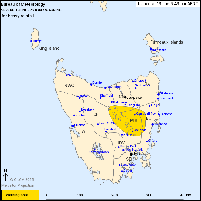
Source: Bureau of Meteorology
For people in Midlands and parts of East Coast, Central North,
Central Plateau and North West Coast Forecast Districts.
Issued at 6:43 pm Monday, 13 January 2025.
Slow moving severe thunderstorms with heavy rainfall have
developed over inland parts.
Weather Situation: Weather Situation: A warm and moist airmass
lies over the north and central parts of the state, which has led
to the development of slow-moving thunderstorms capable of heavy
rainfall. Severe thunderstorms may persist for the next couple of
hours before easing later in the evening.
Severe thunderstorms are likely to produce heavy rainfall that may
lead to flash flooding in the warning area over the next several
hours. Locations which may be affected include Oatlands and
Campbell Town.
The State Emergency Service advises that people should:
* Avoid driving, walking or riding through flood waters.
* Seek shelter, preferably indoors and never under trees.
* Avoid using the telephone during a thunderstorm.
* Beware of fallen trees and powerlines.
* For emergency assistance contact the SES on 132500.

13/Jan/2025 07:54 AM


