
Source: Bureau of Meteorology
Issued at 12:07 pm EDT on Tuesday 28 November 2023
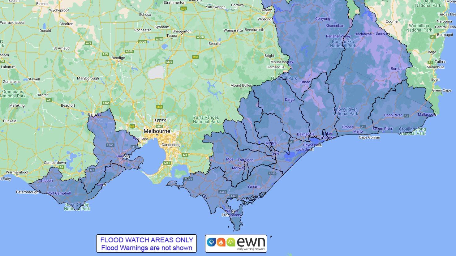
Flood Watch Number: 1
WIDESPREAD MINOR WITH MODERATE TO MAJOR FLOODING POSSIBLE ACROSS
THE FLOOD WATCH CATCHMENTS FROM WEDNESDAY
A low pressure trough will extend over Victoria on Tuesday and
Wednesday associated with a deepening surface low moving across
southern NSW. The low is expected to move into the Tasman sea on
Thursday and back in to eastern Bass Strait on Friday, before
finally moving away from Victoria during the weekend. This will
bring widespread rain and showers over the State with possible
heavy falls in the east and south Gippsland during Wednesday and
Thursday.
Catchments are relatively dry. Widespread rainfall totals of
50-100 mm are forecast across the flood watch area during
Wednesday. Further rainfall totals of 40-80 mm are forecast on
Thursday with isolated higher totals possible.
River level rises are expected and minor flooding is possible for
the catchments listed from Wednesday. Potential for moderate to
major flooding with higher possible rainfall totals.
Catchments likely to be affected include:
Bemm, Cann and Genoa Rivers
Snowy River
Tambo River
Mitchell River
Avon River
Macalister River
Thomson River
Latrobe River
Traralgon Creek
Gippsland Lakes
South Gippsland Rivers
Barwon, Leigh and Moorabool Rivers
Otway Coast
Upper Murray and Mitta Mitta Rivers
The Bureau of Meteorology is continuing to monitor the situation
and will issue catchment specific warnings as required.
See www.bom.gov.au/vic/warnings to view the current warnings for
Victoria.
For more information on the Flood Watch Service:
http://www.bom.gov.au/water/floods/floodWarningServices.shtml
Flood Safety Advice:
Note: This Flood Watch means that people living or working along
rivers and streams must monitor the latest weather forecasts and
warnings and be ready to move to higher ground should flooding
develop.
SES advises that all community members should:
Never walk, ride or drive through floodwater, Never allow children
to play in floodwater, Stay away from waterways and stormwater
drains during and after heavy rain, Keep well clear of fallen power
lines Be aware that in fire affected areas, rainfall run-off into
waterways may contain debris such as ash, soil, trees and rocks,
and heavy rainfall increases the potential for landslides and
debris across roads.
Current Emergency Information is available at
http://emergency.vic.gov.au For emergency assistance contact the
SES on 132 500.
Current Road and Traffic Information is available at the VicRoads
website:
http://traffic.vicroads.vic.gov.au/
Weather Forecast:
For the latest weather forecast see
http://www.bom.gov.au/vic/forecasts/
River Height and Rainfall information are available on the Bureau
of Meteorology web site at http://www.bom.gov.au/vic/flood/
Flood Warnings and Flood Watches for Victorian Catchments are also
available on: Telephone Weather Service No. 1300 659217.
Rainfall and River
Conditions Map
28/Nov/2023 01:15 AM


