
Source: Bureau of Meteorology
For people in parts of South West and Lower West districts.
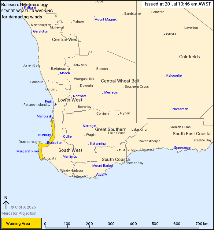
Issued at 10:46 am Sunday, 20 July 2025.
Cold front to bring damaging winds to the southwest coast, easing
this evening.
Weather Situation: The passage of a cold front will bring damaging
northwesterly wind gusts to parts of the southwest coastline from
late this morning, before easing into the evening. While gusty
conditions are likely across much of the South West Land Division,
damaging wind gusts are not expected outside the warning
area.
DAMAGING NORTHWESTERLY WIND GUSTS with peak gusts of around 90
km/h are possible over the warning area and may cause DAMAGE TO
HOMES AND PROPERTY.
Winds are expected to turn southwesterly behind the front and ease
below warning thresholds during the late afternoon and
evening.
People in southwest WA typically experience a front as windy as
this about 5 times per year.
Locations which may be affected include Bunbury, Mandurah,
Margaret River, Busselton, Augusta and Dunsborough.
The Department of Fire and Emergency Services advises that people
should:
* If outside find safe shelter away from trees, power lines, storm
water drains and streams.
* Close your curtains and blinds, and stay inside away from
windows.
* Unplug electrical appliances and do not use land line telephones
if there is lightning.
* If boating, swimming or surfing leave the water.
* Be alert and watch for hazards on the road such as fallen power
lines and loose debris.
* Keep away from flooded drains, rivers, streams and
waterways.
* Be careful of fallen trees, damaged buildings and debris.
* Be careful of fallen power lines. They are dangerous and should
always be treated as live.
* Assess your home, car and property for damage.
* If damage has occurred take photos and contact your insurance
company to organise permanent repairs.
* If your home or property has significant damage, like a badly
damaged roof or flooding, call the SES on 132 500.
20/Jul/2025 03:08 AM


