Latest EWN Severe Weather Alerts
11/Apr/2026 08:35 AM
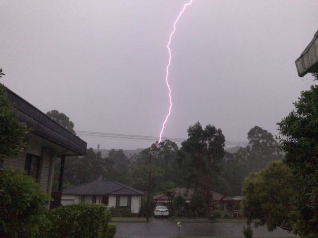
WA Severe Thunderstorm Warning: Damaging Winds
Source: Bureau of Meteorology For people in parts of Pilbara and Gascoyne districts. Issued at 4:25 pm Saturday, 11 April 2026. Gusty thunderstorms about the interior this afternoon. Weather Situation: Broad area of gusty severe thunderstorms hav ... Read more...11/Apr/2026 01:36 AM
TAS Severe Weather Warning: Damaging Winds
Source: Bureau of Meteorology For people in King Island, Furneaux Islands and parts of Western, South East, North East, North West Coast and Central North Forecast Districts. Issued at 11:01 am Saturday, 11 April 2026. Damaging winds about norther ... Read more...10/Apr/2026 12:44 PM
TAS Severe Weather Warning: Damaging Winds
Source: Bureau of Meteorology For people in King Island, Furneaux Islands and parts of Western, South East, North East, North West Coast and Central North Forecast Districts. Issued at 10:38 pm Friday, 10 April 2026. Damaging winds about northern ... Read more...09/Apr/2026 11:34 PM
NSW Severe Weather Warning: Damaging Winds
Source: Bureau of Meteorology For people in parts of Illawarra, South Coast, Southern Tablelands and Snowy Mountains Forecast Districts. Issued at 9:21 am Friday, 10 April 2026. Damaging winds continue for elevated parts of the southeast, easing t ... Read more...09/Apr/2026 11:33 PM
NSW Severe Weather Warning: Damaging Winds
Source: Bureau of Meteorology For people in parts of Illawarra, South Coast, Southern Tablelands and Snowy Mountains Forecast Districts. Issued at 9:21 am Friday, 10 April 2026. Damaging winds continue for elevated parts of the southeast, easing t ... Read more...09/Apr/2026 11:17 PM
TAS Severe Weather Warning: Damaging Winds
Source: Bureau of Meteorology For people in King Island, Furneaux Islands and parts of Western, South East, North East, North West Coast and Central North Forecast Districts. Issued at 9:09 am Friday, 10 April 2026. Damaging winds today about nort ... Read more...09/Apr/2026 11:16 PM
TAS Severe Weather Warning: Damaging Winds
Source: Bureau of Meteorology For people in King Island, Furneaux Islands and parts of Western, South East, North East, North West Coast and Central North Forecast Districts. Issued at 9:09 am Friday, 10 April 2026. Damaging winds today about nort ... Read more...09/Apr/2026 09:08 PM
NSW Severe Weather Warning: Damaging Winds
Source: Bureau of Meteorology For people in South Coast and parts of Illawarra, Southern Tablelands, Snowy Mountains and South West Slopes Forecast Districts. Issued at 4:55 am Friday, 10 April 2026. Damaging winds for elevated parts of the southe ... Read more...09/Apr/2026 08:07 AM
VIC Severe Thunderstorm Warning: Damaging Winds
Source: Bureau of Meteorology For people in parts of North East and Northern Country Forecast Districts. Issued at 6:01 pm Thursday, 9 April 2026. Severe thunderstorms with damaging winds in the North East district. Weather Situation: Severe thun ... Read more...09/Apr/2026 06:51 AM
NSW Severe Weather Warning: Damaging Winds
Source: Bureau of Meteorology For people in South Coast and parts of Illawarra, Southern Tablelands, Snowy Mountains and South West Slopes Forecast Districts. Issued at 4:45 pm Thursday, 9 April 2026. Damaging winds for elevated parts of the south ... Read more...09/Apr/2026 04:44 AM
VIC Severe Thunderstorm Warning: Damaging Winds, Heavy Rain
Source: Bureau of Meteorology For people in parts of Central, North Central and West and South Gippsland Forecast Districts. Issued at 2:39 pm Thursday, 9 April 2026. Severe thunderstorms across central parts of Victoria today, including the Melbo ... Read more...09/Apr/2026 01:15 AM
VIC Severe Weather Warning: Damaging Winds
Source: Bureau of Meteorology For people in parts of East Gippsland, North Central, North East, West and South Gippsland and Central Forecast Districts. Issued at 11:08 am Thursday, 9 April 2026. Damaging northwesterly winds developing later today ... Read more...09/Apr/2026 01:01 AM
NSW Severe Weather Warning: Damaging Winds
Source: Bureau of Meteorology For people in parts of South Coast, Southern Tablelands and Snowy Mountains Forecast Districts. Issued at 10:54 am Thursday, 9 April 2026. Damaging winds for elevated parts of the southeast from Thursday evening. Wea ... Read more...09/Apr/2026 01:00 AM
NSW Severe Weather Warning: Damaging Winds
Source: Bureau of Meteorology For people in parts of South Coast, Southern Tablelands and Snowy Mountains Forecast Districts. Issued at 10:54 am Thursday, 9 April 2026. Damaging winds for elevated parts of the southeast from Thursday evening. Wea ... Read more...08/Apr/2026 11:42 PM
TAS Severe Weather Warning: Damaging Winds
Source: Bureau of Meteorology For people in Furneaux Islands and parts of King Island, North East and Central North Forecast Districts. Issued at 9:35 am Thursday, 9 April 2026. Damaging winds about northern Tasmania on Friday. Weather Situation: ... Read more...08/Apr/2026 11:40 PM
TAS Severe Weather Warning: Damaging Winds
Source: Bureau of Meteorology For people in Furneaux Islands and parts of King Island, North East and Central North Forecast Districts. Issued at 9:35 am Thursday, 9 April 2026. Damaging winds about northern Tasmania on Friday. Weather Situation: ... Read more...08/Apr/2026 06:46 AM
VIC Severe Weather Warning: Damaging Winds
Source: Bureau of Meteorology For people in parts of East Gippsland, North Central, North East, West and South Gippsland and Central Forecast Districts. Issued at 4:29 pm Wednesday, 8 April 2026. Damaging northwesterly winds developing later on Th ... Read more...08/Apr/2026 06:42 AM
NSW Severe Weather Warning: Damaging Winds
Source: Bureau of Meteorology For people in parts of Snowy Mountains Forecast District. Issued at 4:29 pm Wednesday, 8 April 2026. Damaging winds for elevated parts of the alpine area from Thursday evening. Weather Situation: Northwesterly winds ... Read more...07/Apr/2026 01:07 PM
WA Severe Thunderstorm Warning: Damaging Winds, Heavy Rain
Source: Bureau of Meteorology For people in parts of Eucla and Goldfields districts. Issued at 9:02 pm Tuesday, 7 April 2026. Severe thunderstorms over parts of the Goldfields and Eucla. Weather Situation: A trough is causing localised severe thu ... Read more...07/Apr/2026 11:46 AM
WA Severe Thunderstorm Warning: Large Hail, Damaging Winds, Heavy Rain
Source: Bureau of Meteorology For people in parts of Goldfields, Eucla and South Interior districts. Issued at 7:38 pm Tuesday, 7 April 2026. Severe thunderstorms over parts of the Goldfields and Eucla. Weather Situation: A trough is causing loca ... Read more...07/Apr/2026 09:30 AM
WA Severe Thunderstorm Warning: Large Hail, Damaging Winds, Heavy Rain
Source: Bureau of Meteorology For people in parts of Goldfields district. Issued at 5:25 pm Tuesday, 7 April 2026. Severe thunderstorms over parts of the Goldfields. Weather Situation: A trough is causing localised severe thunderstorms in a moist ... Read more...07/Apr/2026 08:05 AM
WA Severe Thunderstorm Warning: Large Hail, Damaging Winds, Heavy Rain
Source: Bureau of Meteorology For people in parts of Goldfields district. Issued at 4:01 pm Tuesday, 7 April 2026. Severe thunderstorms over parts of the Goldfields Weather Situation: A trough is causing localised severe thunderstorms in a moist, ... Read more...06/Apr/2026 11:32 AM
WA Severe Thunderstorm Warning: Damaging Winds
Source: Bureau of Meteorology For people in parts of Goldfields and South Interior districts. Issued at 7:25 pm Monday, 6 April 2026. Severe thunderstorms continuing over parts of the Goldfields and Southern Interior. Weather Situation: A trough ... Read more...06/Apr/2026 11:31 AM
WA Severe Thunderstorm Warning: Damaging Winds
Source: Bureau of Meteorology For people in parts of Goldfields and South Interior districts. Issued at 7:25 pm Monday, 6 April 2026. Severe thunderstorms continuing over parts of the Goldfields and Southern Interior. Weather Situation: A trough ... Read more...06/Apr/2026 09:13 AM
WA Severe Thunderstorm Warning: Large Hail, Damaging Winds, Heavy Rain
Source: Bureau of Meteorology For people in parts of Goldfields and South Interior districts. Issued at 4:51 pm Monday, 6 April 2026. Severe thunderstorms developing over parts of the Goldfields and Southern Interior. Weather Situation: A trough ... Read more...