
Source: Bureau of Meteorology
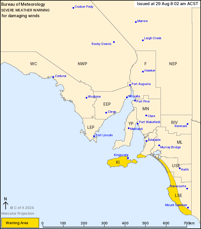
For people in Kangaroo Island and parts of Mount Lofty Ranges,
Upper South East and Lower South East districts.
Issued at 8:02 am Thursday, 29 August 2024.
Damaging winds developing over the south on Friday.
Weather Situation: a strong cold front will pass to the east of SA
overnight into Friday morning. A vigorous west to northwesterly
airstream is then expected to develop in the wake of the front over
the south and southeast of the state.
DAMAGING WINDS averaging 50 to 65 km/h with peak gusts of around
90 km/h are possible during the early hours of Friday morning over
coastal parts of the Lower South East. The risk of DAMAGING WINDS
will then extend to the remainder of warning area including
Kangaroo Island and the Fleurieu Peninsula later on Friday
evening.
Locations which may be affected include Kingscote, Robe and
Millicent.
The State Emergency Service advises that people should:
* Move vehicles under cover or away from trees;
* Secure or put away loose items around your property.
* Stay indoors, away from windows, while conditions are
severe.
28/Aug/2024 10:43 PM

