
Source: Bureau of Meteorology
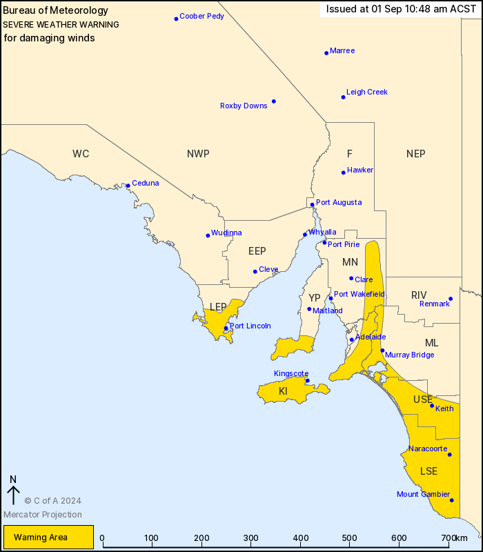
For people in Mount Lofty Ranges, Kangaroo Island, Upper South
East, Lower South East and parts of Lower Eyre Peninsula, Yorke
Peninsula, Mid North and Murraylands districts.
Issued at 10:48 am Sunday, 1 September 2024.
Damaging winds over the south easing Monday.
Weather Situation: A vigorous west to northwesterly airstream will
persist over the south of the state. A strong cold front embedded
in the westerly flow will pass along the southern coast tonight
bringing a risk of damaging winds to the south and southeast.
Strong westerly winds with DAMAGING WIND GUSTS around 90 km/h are
possible over the warning area, possibly reaching around 100 km/h
near southern coasts and east of the Mount Lofty Ranges for a
period late this evening with the passage of a cold front.
DAMAGING WINDS averaging 50 to 65 km/h are likely near southern
coasts.
Late Sunday evening, there is a risk of DESTRUCTIVE WIND GUSTS
reaching around 125km/h about the Lower South East coast south of
about Robe for a brief period with the passage of the cold
front.
Locations which may be affected include Port Lincoln, Mount
Gambier, Kingscote, Naracoorte, Meningie and Strathalbyn.
The State Emergency Service advises that people should:
* Move vehicles under cover or away from trees;
* Secure or put away loose items around your property.
* Stay indoors, away from windows, while conditions are
severe.
01/Sep/2024 01:40 AM

